Relative Elevation Map
Elevation Relative to the River at the Border of Noord Brabant and Zuid Holland
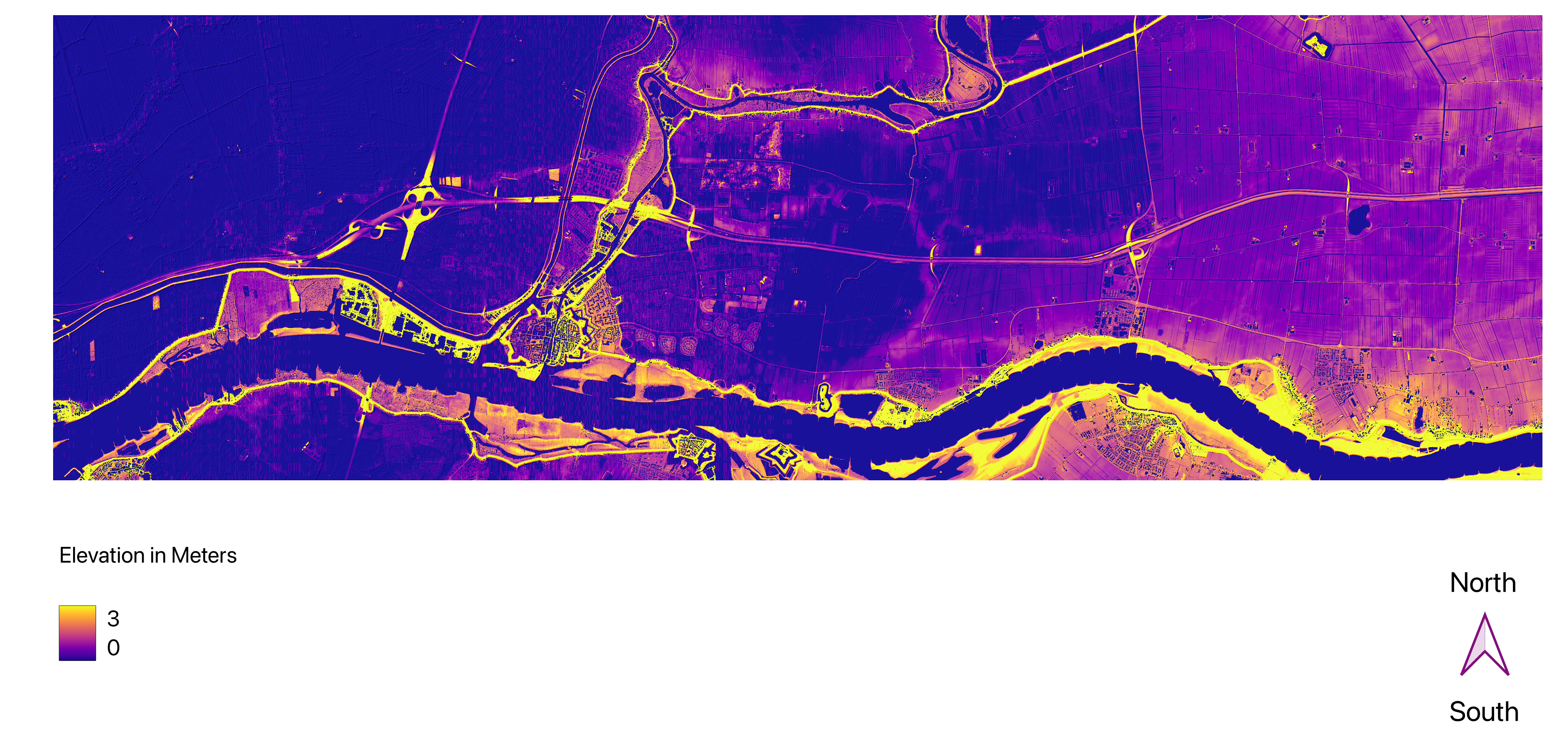
This map visualizes the elevation relative to a river. The area that the map captures displays the border (river) between Noord Brabant and Zuid Holland. The map was made with QGIS and its data was derived from Open-Source LiDAR (Light Detection and Ranging) data. Although the area is quite flat, elevation of up to 3 meters is very noticeable, especially around the river's edges. A color scheme consisting of yellow, pink, and purple has been chosen for this map, where deep purple shows the lowest elevation (=0) and yellow shows the highest elevation (=3). This makes the elevation differences well distinguishable. In this context, a relative elevation map can, for instance, be used to understand potential flood risks in the area of the river.